
New Heights
How camera drones are expanding perspective
Written by Stephanie Cheng // Photos by Kjell Redal and Jake Tull
The sound of loud whirring fills the otherwise quiet, brisk fall air. Phillip Wu stands in the Performing Arts Center Plaza at Western Washington University, holding a large white remote controller in his gloved hands. His jet black hair is wind-blown and messy, his cheeks pink from the cold. His white vans stand out, the rest of him clad in all black.
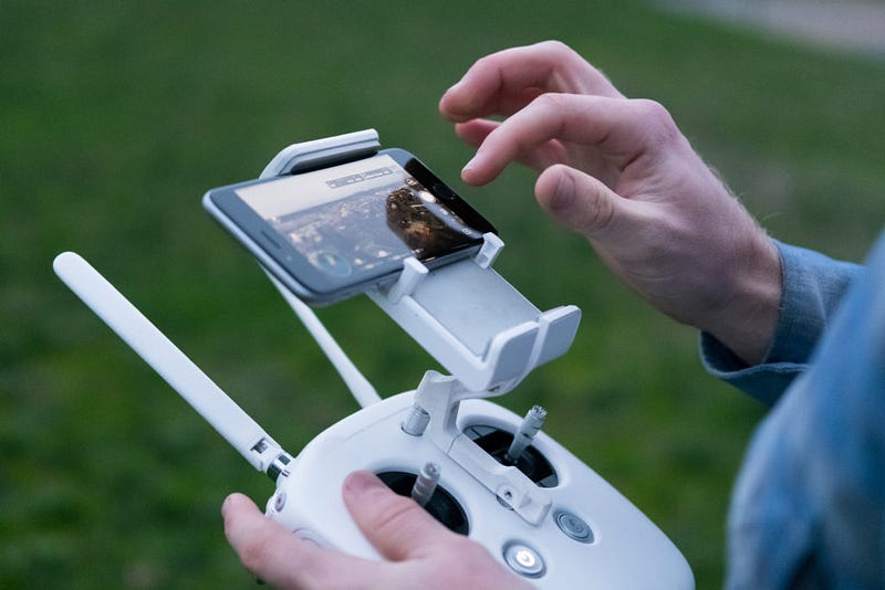
“I’m trying to get a shot of campus,” Wu says, brown eyes darting from the drone hovering in the air and his phone that’s attached to the remote control. “It’s kind of hard though because it’s a little windy today.”
Bellingham, Washington, while beautiful, is notorious for its wind blowing leaves out of trees and now just as easily, drones out of the sky. As drone cameras increase in popularity, the world has started to shift to accommodate the new technology.
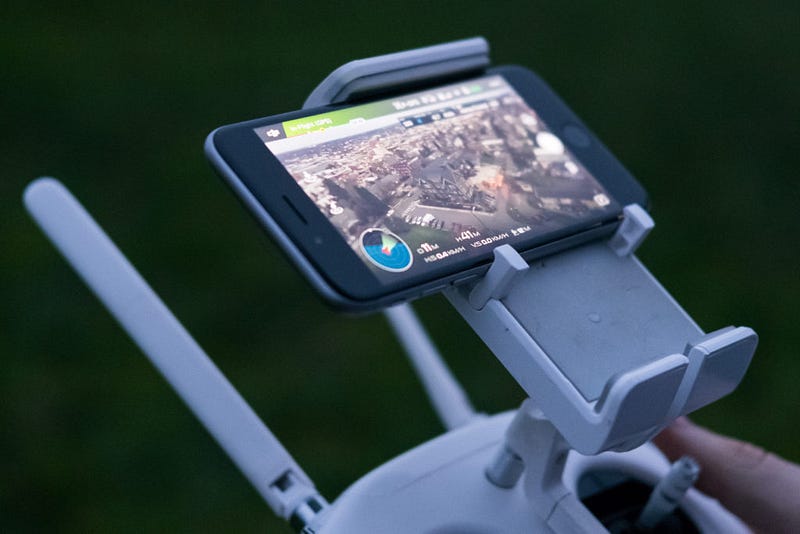
The DJI GO app shows the view of downtown Bellingham as seen from a drone 41 meters up.
Wu controls the drone, a DJI Phantom 3, with his phone and the remote controller, working in unison to both pilot the drone and record footage.
A sophomore at Western, Wu has always been interested in landscape photography, which played a significant role in his choice to attend Western. “It’s, like, really pretty here,” he says, shrugging his shoulders, as his eyes focus on the drone.
Wu’s Instagram profile is filled with pictures of the Pacific Northwest landscape along with other photos from his travels. He normally shoots with his phone or his Canon Rebel T3i. Drone photography is his latest venture.
“It’s always been super frustrating when you know there’s a shot that would be really great from above, but you obviously can’t go that high without paying for a helicopter,” Wu says. “I was watching this vlogger who uses a ton of drone stuff in his videos, so I bought one.”
The vlogger Wu talks about is Casey Neistat, a professional filmmaker and YouTube creator, known for his viral videos and his nontraditional ways of storytelling. Neistat’s more recent work heavily features video shots from different drones, such as the DJI Phantom series, GoPro and most recently the DJI Mavic.
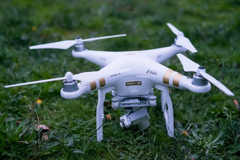
A DJI Phantom 3 4K drone sits in the grass waiting to be flown.
Wu considers Neistat a big influence. “I don’t really make videos, but the pictures are worth it, I guess.”
What comes with dynamic pictures is the hefty price tag and the difficulty of operating the drone.
“I have a carrying case, but it’s so heavy that I kind of stopped using it. I tried making my best friend carry it, but he always complains,” Wu says, laughing.
Wu says that the overall price of the drone, the carrying case and the protection plan cost him around $710. “It was a big investment. It cost so much money.”
Learning how to use the drone was a beast of its own.
“I crashed it so many times,” he admits. “But it was really lightly. And I only broke it, like really broke it, once.”
Wu uses the DJI Go app on his phone to pilot the drone and has had some trouble with functionality. “The really bad crash I had was when I tried to use the ‘return to home’ function and it just crashed into a tree.”
He shakes his head, remembering the event. “All I could think about was $700 in the sky, but it’s fine now. I’m better at it.”
Another caveat that Wu has run into is Federal Aviation Administration (FAA) regulations on drone use. Drone users are required to register their device as an unmanned aircraft with the FAA if it weighs between .55 and 55 pounds. WU’s DJI Phantom 3 weighs 2.82 pounds.
Guidelines for those flying for fun differ from those flying for work. A commercial drone user must obtain an airworthiness certificate to prove responsibility, whereas recreational users need only fly under the Special Rule for Model Aircraft, which sets rules on flying nearby airports and keeping drones within visual lines of sight.
In June 2014, the National Park Service launched a temporary drone ban in America’s national parks to protect wildlife, visitor experience and fire management operations. Due to concerns about mid-air collisions, firefighting aircraft cannot take off if drones fly over wildfires, according to the National Interagency Fire Center. Last August, public drone use grounded wildfire water drops in Olympic National Park.
National parks have long been a location for many photographers, including Wu.
Users can consult “Know Before You Fly” to find out where they can fly their aircraft. The website provides airspace maps showing airports, heliports, temporary flight restricted areas such as wildfires, prohibited or restricted airspace, National Oceanic and Atmospheric Administration marine protection areas and national parks.
“[The drone] is hard to travel with so I don’t take it too far,” Wu says. “I have to be really careful because the parks are really big and I don’t want to lose it or get in trouble.”
Wu is one of many photographers and videographers who have embraced the ever-changing nature of technology. Drones are only the most recent installment of photo and video equipment, allowing individuals to introduce new perspectives and widen the radius of their work.
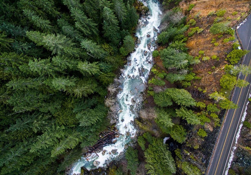
Only a drone can see what’s around the corner.
Klipsun photographer Kjell Redal shows how settings can be changed from a phone app.